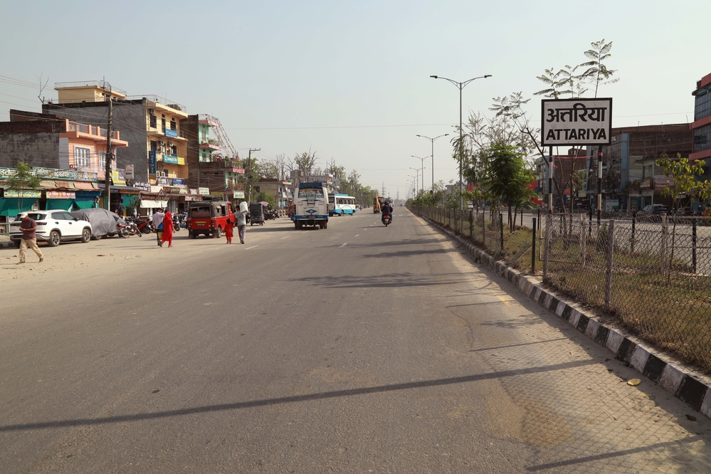
When the East-West Highway was first laid during the reign of King Mahendra, there was forest all around except for Attariya Chowk.
We use Google Cloud Translation Services. Google requires we provide the following disclaimer relating to use of this service:
This service may contain translations powered by Google. Google disclaims all warranties related to the translations, expressed or implied, including any warranties of accuracy, reliability, and any implied warranties of merchantability, fitness for a particular purpose, and noninfringement.
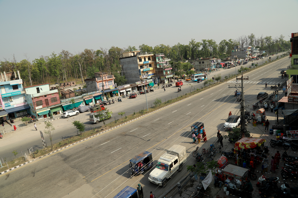
Attariya Crossroads, located in the center of 9 districts including Kailali and Kanchanpur in the Terai, has become a buzzing place in recent years. Attariya is the gateway connecting the hills and the Terai in the Far Western Province. Along with the hilly terrain, Attariya Crossroads is also the first stop for people traveling to all four directions of the country, crossing the Bhawar region of the Terai.
Not only this, it is also the crossroads where people enter India via the border checkpoint of Gaurifanta in Kailali and Gaddachauki in Kanchanpur. Young people who have come down from remote hills in search of work through this crossroads are seen heading towards Gaurifanta and Gaddachauki every day. Young workers from the Tharu community of Kailali and Kanchanpur have also been added to those entering India for employment through Attariya Crossroads in recent years.
When the East-West Highway was first laid during the reign of King Mahendra, there was forest all around except Attariya Chowk. The only old settlements nearby were Geta and Malakheti. Those who came down from the mountains to the Terai used to travel along the footpaths of the old settlements to Kailali, Kanchanpur and India. Since the 1920s, when the construction of the East-West Highway and the construction of the Dhangadhi-Dadeldhura Highway connecting the hilly areas began, settlements have also started expanding in the Attariya Chowk and surrounding areas.
‘There was a small market in Geta, the old settlement south of the intersection, and a market in Malakheti in the west,’ says Ramchandra Awasthi (aged 72), who reached Attariya from Doti at the age of 11. ‘Attariya has changed its face after the construction of the East-West Highway and Dhangadhi-Dadeldhura Highway started.’ It took years to build the Dhangadhi-Dadeldhura Highway. In 2021, the situation in Attariya started changing after the road cutting from Dhangadhi to the Godavari at the foot of Attariya started.
Road construction also started in the twenties, and Awasthi says that after natural disasters in the hills started increasing hunger, migration from remote hilly areas started. ‘As per the plan to expand settlements in the border area, forest was cleared around Attariya in 2023 BS by King Mahendra’s order,’ he said. ‘After that, people started coming down from the hills and the settlements here started spreading.’ He said that settlements and markets in Attariya started expanding only after the construction of the Dhangadhi-Dadeldhura highway started progressing.
Dhangadhi, the temporary capital of the Far West Province, is located 15 kilometers south of the Attariya intersection. To the north of the Attariya intersection, there are 7 hilly districts of the Far West, stretching from the Himalayas to the high mountains and the mid-hills—Bajura, Bajhang, Darchula, Doti, Dadeldhura, Baitadi and Achham. The main road section connecting all these districts, which serves as the ‘lifeline’ of the Far West, is the Dhangadhi-Dadeldhura highway.
The area where the Attariya intersection is located in Ahil was once part of the Malakheti Rural Municipality and Geta Rural Municipality. From the Panchayat period to the present, the boundaries and areas have changed at various times, and Attariya intersection is in Godavari Municipality-1 and 2. Until 2036 BS, there were only 2/4 pucca houses of some Indian-origin businessmen in Attariya. Local Ramchandra Awasthi says that Attariya has been expanding into a modern city over a period of about 40/50 years. ‘I still remember Chet Sahni’s tea shop and the old pucca house of businessman Jayaraj Mohpal to the north of the intersection,’ Awasthi said, ‘Now if we look at the current intersection, it has changed like the sky and the underworld.’
Businessman Yagyaraj Joshi, who started living in Attariya since 2043, says that initially there were only a few grocery stores in a few dilapidated tin huts in Attariya. ‘There was a pothole where the current square is, water would stagnate, and there would be no market,’ he said, ‘After connecting to the East-West Highway, Attariya has become the center of the Far West.’ Joshi says that since Attariya has come down from the mountains, it is possible to go anywhere, and the number of vehicles and passengers has increased, and business activities are increasing here along with hotels and lodges.
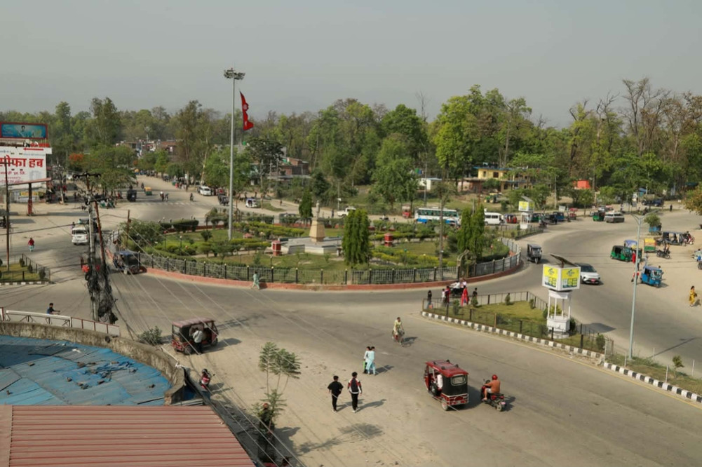
Attariya, which used to be as deserted as a desert in the past, has become lively in recent years. The national flag fluttering in the main square of the square, where there is a statue of King Mahendra, water fountains and greenery have increased the attractiveness of the square.