How to restructure the local level? On what basis? For whom? Why? Should geography or population be prioritized during restructuring? Some say – there are large geographies, but few people. Others say – there are many people, but small geographies. The debate on restructuring municipalities based on population density is also widespread.
We use Google Cloud Translation Services. Google requires we provide the following disclaimer relating to use of this service:
This service may contain translations powered by Google. Google disclaims all warranties related to the translations, expressed or implied, including any warranties of accuracy, reliability, and any implied warranties of merchantability, fitness for a particular purpose, and noninfringement.
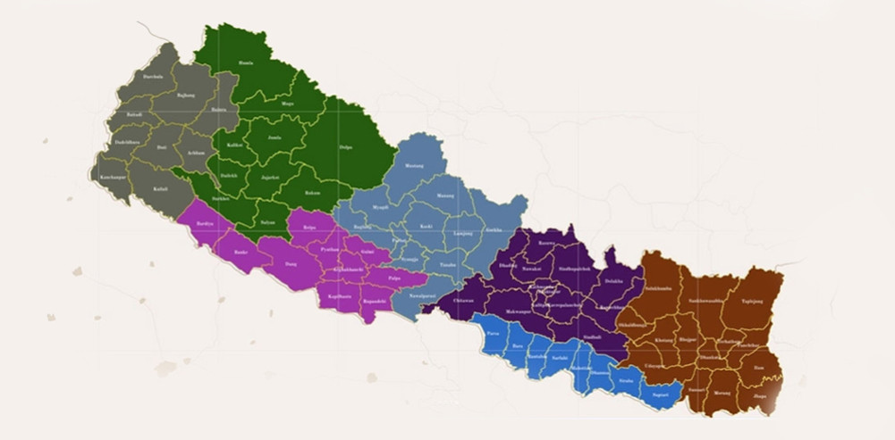
There are three levels of government in Nepal - local, provincial and federal. In 2073, the government restructured the local level to convert VDCs into rural municipalities. For that, a commission was formed under the chairmanship of Balananda Poudel. The commission reduced about 4,000 VDCs to 460. Initially, 744 local level blueprints were submitted, including municipalities. However, that was not universally accepted. After the Madhesh parties did not recognize it, 9 local levels were added, bringing the total to 753 local levels.
It has been 9 years since the formation of the local government. After 10 years, the second election will be held at the local level. According to the Local Self-Government Act, decisions such as changing the boundaries of local levels, changing names, merging or separating them, changing the center of local levels or wards, etc., must be made the year before the election. Therefore, with 9 years of experience, political parties, local government representatives and the Ministry of Federal Affairs are also engaged in the internal homework of local level restructuring.
Restructuring of local levels is done, but how? On what basis? For whom? Why? These questions have been widely raised. While restructuring these levels, should priority be given to geography or population? Some say – there are large geographies, but few people. Another group says – there are many people, but small geographies. The local level is for the service of citizens, so there is also a demand that the number of local levels should be increased wherever there are citizens. In other words, there is a great debate and demand that we should restructure the municipality based on population density.
Geography first or population in state restructuring? This debate has always arisen. Even during the Panchayat period, there was a debate about whether population should be given priority or geography should be given priority. One group said that population should be given importance, the other group said geography. When the demarcation of village panchayats was done for the first time in 2018, an area with a population of 1,500 was made into a panchayat. This panchayat remained in existence for about 30 years. There were some changes in the population. In 2047, the multi-party system was restored. At that time, the names of the panchayats that were local bodies were changed, but the boundaries were not changed. Only the village panchayats were replaced by village development committees and the city panchayats by municipalities. Municipalities were upgraded based on population and revenue and made into metropolises and sub-metropolitan cities.
Local level is not just a geographical area
Local level restructuring is not just a geographical area. Political parties have interests in it. The politics of increasing or decreasing a municipality is not limited to numbers. There are many political, social, economic, educational and employment opportunities within the structure of a municipality. If a municipality is reduced, the possibility of a politician becoming a chairman ends. The possibility of someone becoming a ward chairman ends. The financial subsidy received from the government decreases. The possibility of employment and trade created by the municipality and ward center also decreases. On the contrary, where a municipality is added, all these opportunities accumulate. Politicians, businessmen, and intellectuals in search of opportunities leave their homes in search of such possibilities. The issue of reducing or increasing the number of municipalities is not only geographically divided. It is also a matter of increasing or decreasing the foundation of the political future. It is also a process of making the common man positive towards democracy by providing services in the home and courtyard.
Even within the same geography, its beliefs differ. The density is higher in district headquarters in mountainous or hilly geography. Big cities have not been able to expand in hilly geography. That is why hilly cities are the markets of district headquarters. As people from all over the district start flocking towards that area, the number of municipalities in the villages in those places is pulled by the district headquarters. And, federalism creates dissatisfaction over whether to decentralize opportunities and facilities or to centralize them.
Geography: Himalayas and hills, population: Terai
According to the geographical division of Nepal, Himalayas cover 35 percent of the land, hills 42 percent, and Terai 23 percent. If we combine the Himalayas and hills, it covers 77 percent of the land. About 46 percent of the population lives in these two areas. 54 percent lives in the Terai. Due to foreign employment and internal migration, the population of the Himalayas and hills has been decreasing drastically in recent decades. Due to this, many local levels are likely to go into a state of depopulation. The only reason for this is that 250 of the 460 rural municipalities in the country have a negative population growth rate. In terms of municipalities, 69 out of 293 municipalities have a negative situation. The current restructuring should follow this changing trend of population. Based on this, what will be the future population pattern at any local level? That too needs to be estimated. Even if a municipality seems empty considering the current situation, if it adopts a new method of returning people in the future, there may be a large number of reverse migration. Therefore, it is necessary to pay attention to the restructuring of the municipality by making a long-term strategy based on the current demographic indicators and the future prospects.
There is an argument that after the previous restructuring, it became difficult to get services and facilities in the hills, remote areas became even more remote, and economic and employment opportunities suddenly shrank, leading to a large number of people migrating to the Terai. One truth is that after the formation of rural municipalities from VDCs, a large number of people have left their places. The government's preparations to reduce more municipalities by citing the same reason that made the hills desolate seem to further reduce the hills to a state of political helplessness and resource constraints. Advocates of hill development argue that the country will be united if the number of local levels is reduced to make the deserted hills more convenient and bring people back.
We can reduce municipalities, but what about districts? This is the current complicated debate. The constitution has not recognized the existence of districts. Part 5 of the constitution, 'Structure of the State and Distribution of State Power', has clearly defined the jurisdiction of only three levels. Although the list of districts is mentioned in Schedule 4, the constitution has not given importance to this structure. Political parties have kept these structures, which play a coordinating role, in an executive role. The federal government has also kept the District Coordination Committee, Chief District Officer and Police Chief in the executive role of the district, which in some cases makes the district dominate the decisions of the municipality. If there is no district structure, the restructuring of the municipality takes a new turn. Due to the district boundaries, the boundaries of the local levels with municipal centers at a distance automatically coincide. Now, because the districts have separated their borders, people are not able to easily avail the facilities provided by federalism.
Local level: Demographic imbalance like geography
Just as Nepal's population is being centralized from the mountains and hills to the Terai, the same scenario is also seen at the local level. Geographically, the population is thin in the mountains and hills, which are large in size, but the population density is dense in the Terai, which is small in geography. According to the 2078 census, the municipality with the lowest population in Nepal is Thuliveri Municipality in Dolpa. The population there is 9,861. This population growth rate is almost double the average of Nepal, i.e. 1.57 percent. The population density is 23 people per square kilometer. The most populous local level is naturally the federal capital Kathmandu. The population of Kathmandu Metropolitan City is 862,400. The annual population growth rate of this metropolis is -1.18. The population density is 17,400 per square kilometer. Every year, some opportunity continues to attract people to Thulibheri, due to which the population of Thulibheri is growing rapidly even when the population growth rate of the country is declining. Kathmandu has reached the peak of urbanization and is gradually retreating from urbanization (de-urbanization). Therefore, it seems that the attraction of people has started to decrease here or even if they want, people are not able to establish their access to this metropolis.
Similarly, towards the rural municipality, the population of Narpabhumi in Manang is only 396. In 2068, the population of this municipality was 538. Its growth rate is -2.94 percent. Out of the area of this rural municipality, one person lives in about two square kilometers. The most populous rural municipality is Baijnath in Banke. About 70 thousand people live here. The population growth rate is also 2.34 percent per year and the population density is 490 per square kilometer.
According to geographical region, what is the distribution of population at the local level? Let's look at that data. When the total population of Nepal is 29,164,578 divided by 753 local levels, it is seen that an average of 38,731 people live in one local level. There is an average of 13,851 in the 128 local levels in the Himalayan region, an average of 26,622 in the 328 local levels in the hilly region (excluding Kathmandu Valley), and an average of 56,644 in the Terai. Out of the 21 local levels in the Kathmandu Valley, one local level has an average of 144,066 people. Looking at this situation of population distribution at the local level, it seems that one local level has been able to provide services to about 150,000 people easily? Or has a local level with 396 residents provided services to every citizen's home? What is the difference in the service delivery methods of these two local levels?
While the restructuring of the local level is being voiced, most of the local levels are in the Terai and urban areas if the population is kept in the center. This may cause injustice to the people of the mountainous and hilly areas. If a large geography is to be made into a single municipality, it will be difficult to meet the services provided by the local level and the services received by the citizens. Therefore, it is appropriate to make special arrangements for the geography with very low population in the restructuring so that the people can receive services easily.